Hiking Galatea Trail in Kananaskis Country to Lillian Lake and Lower Galatea Lake
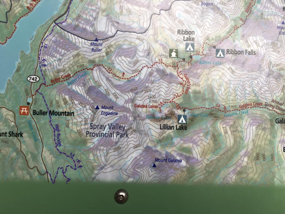
How to get to Galatea Trailhead?
Finding the Galatea Lillian Lake Hike from Calgary take HWY #1 to HWY 40. ( 1 hour and 13 minutes )Look for Galatea Creek and Lillian Lake Trailhead sign.
Hiking Galatea trail to Lillian Lake and Lower Galatea Lake.
The Galatea hike to Lillian Lake is 14.6-kilometer return with another 1.5 km to lower Galatea and a hop skip and a jump to upper galatea which results in a 10-mile hike, with a total elevation of 3018.4 ft gain. A 16.9 km hike in total.

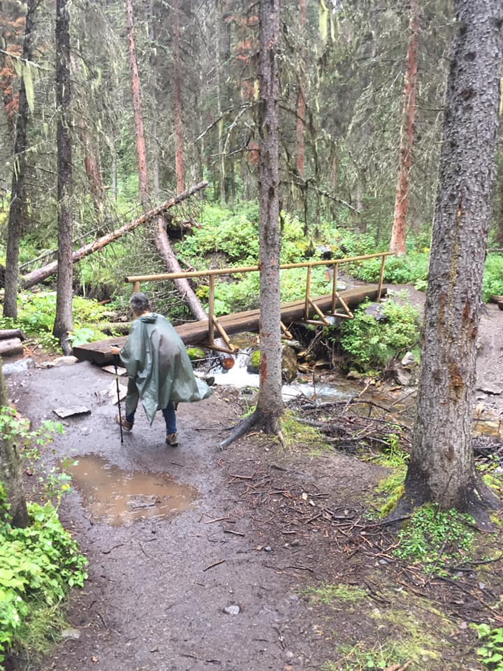
The start at the first bridge My hubby remained dry as I got soaked. One of the many waterfalls 
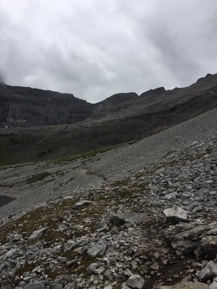
Terrain is a bit rough Some of the many pools to soak on a warm day Overlooking Lillian Lake Just up around the bend to lower Galatea


Choose your clothing wisely
This hike is really quite beautiful even on the day we picked we were tested by the elements of mother nature. We experienced rain, thunderstorms, lightning, and even snow in the higher elevations. Drenched was an understatement however, this is because I chose a disposable poncho over a good waterproof jacket as my husband wore. He remained quite dry. (See photo above)
Not saying ponchos don’t work, they do, but not great for steep uneven terrain and steady rain as the rain drips off poncho onto your cloths and down the hood and are not breathable.
The hike itself is a long one and quite grueling I must say with very uneven terrain as well as the elevation. Definitely glad to have my trekking poles as they saved me many times
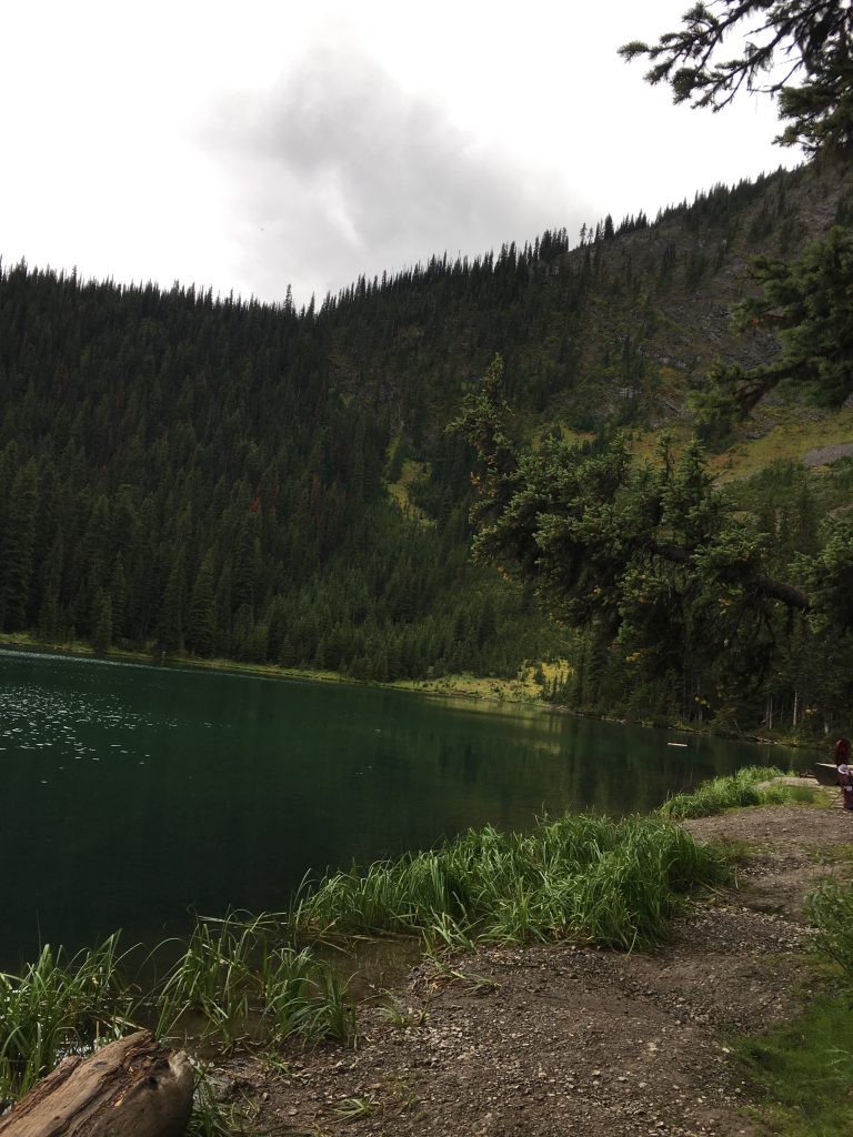
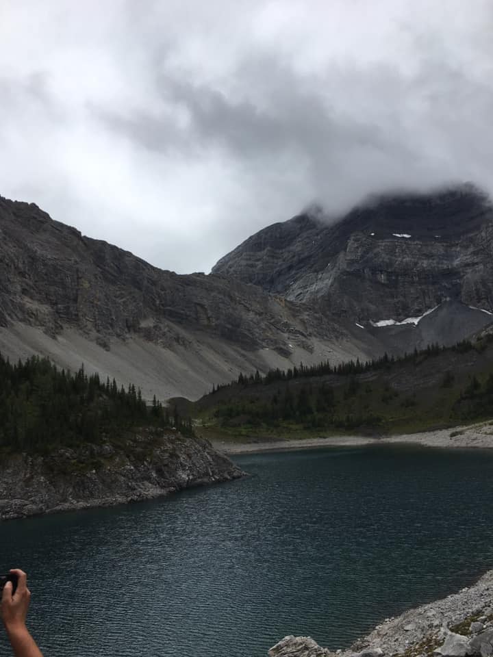
Lillian Lake
When you reach Lillian Lake you will find a prestigious green lake. Here people settle for a picnic or for a night before trekking onward or as their final destination. Set up camp on one of the 15 pads and do some fishing for trout and cutthroat. Enjoy some marshmallows on allotted firepits. As well they have pit/vault toilets.
11 Bridges
Galatea hike consists of 11 bridges that criss-cross the creeks. They vary from 2 flat logs to bridges with rails. All with stunning views of creeks and waterfalls.
Uneven Terrain
The terrain is tricky throughout the hike and proper footwear is a must. Although dogs are permitted, I found the dogs I encountered were a bit stressed and sore. I’d rethink this hike for dogs but that’s my opinion.
What to see on Galatea hike?
The hike itself is for the most part in the trees with a few open ranges to grasp the stunning views as well as look down to see how far you’ve come. Been on many hikes but this hike made me feel as if we were above the clouds and on top of the world. Strange to find 3 beautiful lakes along the way and so high up.
This is a long hike and can be extended farther to Ribbon Creek which would be a 25 km hike end to end. You may also decide to hike to Spray Lakes and Lost Lake Route from this hike as well. These hikes usually require overnight stays.
Having the essentials for hiking is a must.
Related Posts


About The Author
tracigrossi@gmail.com
Editor in chief of the Internet Housewife blog!