Wind Ridge Hike Alberta
Where is Wind Ridge Trail?
Wind Ridge Trailhead is based at the bottom of Pigeon Mountain which is adjacent to the Banff Gate Mountain Resort. Access from Dead man’s Flats interchange.
Wind Ridge Hike is rated Difficult
This trail is closed between Dec 1 – June 15 in the effort to protect the local wildlife


Hiking Wind Ridge Trail
Wind Ridge Hike trail starts off on a well-beaten path for about 2 km crossing a couple of bridges. This is a nice short hike for beginners and ones who like to take a stroll. The path has a fork where to the right is the horse trail and to the left is the foot trail.
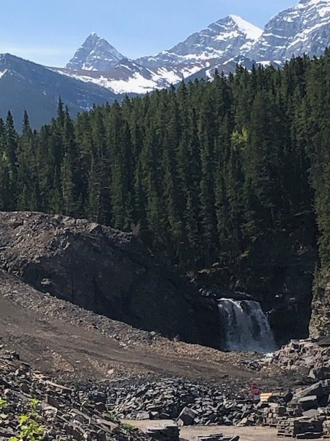
You will come to another creek that is absolutely stunning. This may be a good point to turn back for beginners.


Once you reach this creek it is a great place to rest and look around as you will need the break for the trek ahead. Look around for the little waterfalls, grassy knolls, and take a few photos. My favorite spot on this hike I call the cripple creek.
Ascending ahead to the summit of Wind Ridge

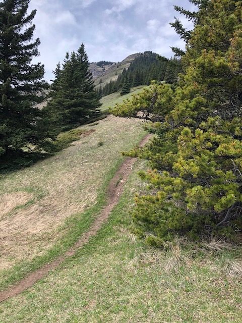
Narrow pathway 
The first lookout


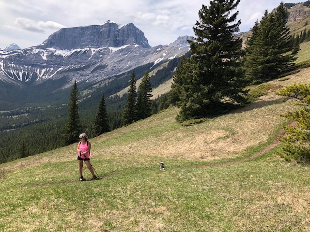
Leaving the creek you will start to ascend where you can view the creek from above. The path becomes a bit narrower as you go. There are some grassy open areas along the trail. The trail becomes steeper for the rest of the hike. This is where you test your capabilities. I must say, I wanted to quit a couple of times. Once we reached the first lookout you will see how far you’ve come and backing out now is not an option.
A bit of a scramble to the lookout beyond the lookout


Continuing on, the path becomes steeper and the terrain gets rougher. Not necessarily a scramble but rocky and uneven for sure.
This lookout you can see the Bow River in the distance


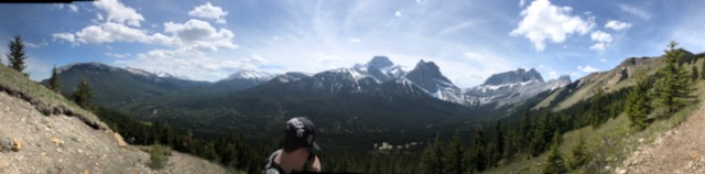
The view is spectacular. Once you reach the top you can take a path to the right where you may find a rock pile made by past hikers. The path will lead you to a great place t rest and have lunch with a panoramic view of where you started and the path ahead to reach the summit. We chose to make this our final trek.
Surprisingly, we came across a hiker who ran the whole distance, yes up and down from what I understood. Also a group of bikers who pushed and carried their bikes up to this point to then carry one down the bow river lookout path to the bottom riding. Crazy!! That’s some pretty extremists right there. Seeing these people give you the extra push to carry on for sure.
Conclusion:
The path to the summit really looks beautiful and not all that hard although this hike is very challenging and to make it to this point is a feat in itself as well as one to be proud of. Once you reach the top of a hike the amount of joy and satisfaction and accomplishment is beyond words.
I highly recommend this hike. Not for the faint of heart although making it to the crippled creek is a great beginner hike.
I am really proud of my accomplishment as a novice hiker. Hiking Ha Ling Peak and Lower Galatea Lake were sure a test of endurance and your body’s ability to overcome more than I believed it could.
Don’t forget your hiking essentials with you. Enjoy!!
Related Posts


About The Author
tracigrossi@gmail.com
Editor in chief of the Internet Housewife blog!